Military Bases Menu:
• UK Military Bases
RAF Linton-on-Ouse Information:
• History
• Current Aircraft
• Satellite View
• Trackers
• Scanner Frequencies
Location:
• Google Road Map
Travel Info:
• AA Route Finder
• National Rail
• National Express
Satnav Postcode:
• YO30 2AJ
Weather Forecast:
• BBC UK Weather
• BBC Local Weather
Photographs:
• Photographs
Message Board:
• Forum
Trackers:
• Military Aircraft Tracker
• UK Military Aircraft Tracker
• Historic UK Military Aircraft Tracker
• Flight Radar 24
• Plane Finder
• ADS-B Exchange
• Military Ship Tracker
Related Links:
• RAF Linton-on-Ouse Wiki
• Pb-photos Aviation Maps
Runway(s) :
• 6,017ft (03/21)
• 4,390ft (10/28)
RAF Bases
• RAF Benson
• RAF Brize Norton
• RAF Coningsby
• RAF Cranwell
• RAF Leeming
• RAF Linton-on-Ouse
• RAF Lossiemouth
• RAF Marham
• RAF Northolt
• RAF Odiham
• RAF Scampton
• RAF Shawbury
• RAF Valley
• RAF Waddington
• RAF Wittering
RAF Bases operated by USAF
• RAF Fairford
• RAF Lakenheath
• RAF Mildenhall
Fleet Air Arm Bases
• RNAS Culdrose
• RNAS Yeovilton
Army Air Corps
• Aldergrove
• Dishforth
• Middle Wallop
• Wattisham
MoD
• Boscombe Down
Relevant Links:
• UK Military Bases Photographs
• Speed of Sound
• DSLR cameras & lens
• Airband Scanners
• Airport Scanner Frequencies
• RAF / Airshow Scanner Frequencies
• Live aviation
RAF Linton-on-Ouse is located north-west of York in North Yorkshire.
The Station's former role was to train fast jet pilots for the RAF and Royal Navy. With the transfer of pilot training to RAF Valley in 2019, the station closed in 2020. In February 2021, the MOD confirmed that no alternative military use had been identified for the site and that it would therefore be sold.
Approach - 370.725, *362.300 LARS (Zone) - 363.400, 118.550 Director - 389.675 PAR - 340.775, 375.575, *123.300 Tower - 129.350, 259.575, *257.800 Ground - 278.125, *122.100 A/G - 118.550 ATIS - 335.700 *= NATO Common Frequency |
| Add Your Photographs |
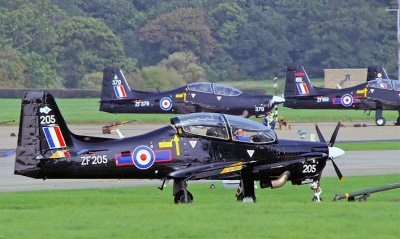
 RAF Tucano T1.
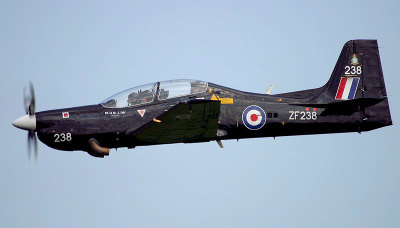
 RAF Tucano T1.
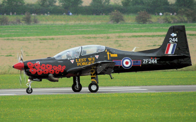
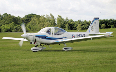 Grob Tutor T1.
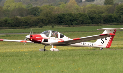 Vigilant T1.